This post was updated on 26 February, 2021 to reflect a corrected analysis.
Children are particularly vulnerable to air pollution’s health impacts. To better understand how London’s young people are being exposed to pollution, we looked at a new modelled dataset produced by Cambridge Environmental Research Consultants (CERC) as part of the Breathe London pilot project that reveals a breakdown of nitrogen oxides (NOx) pollution sources at 1,795 primary schools across the city.
Here are 3 key findings about NOx pollution at London primary schools:
-
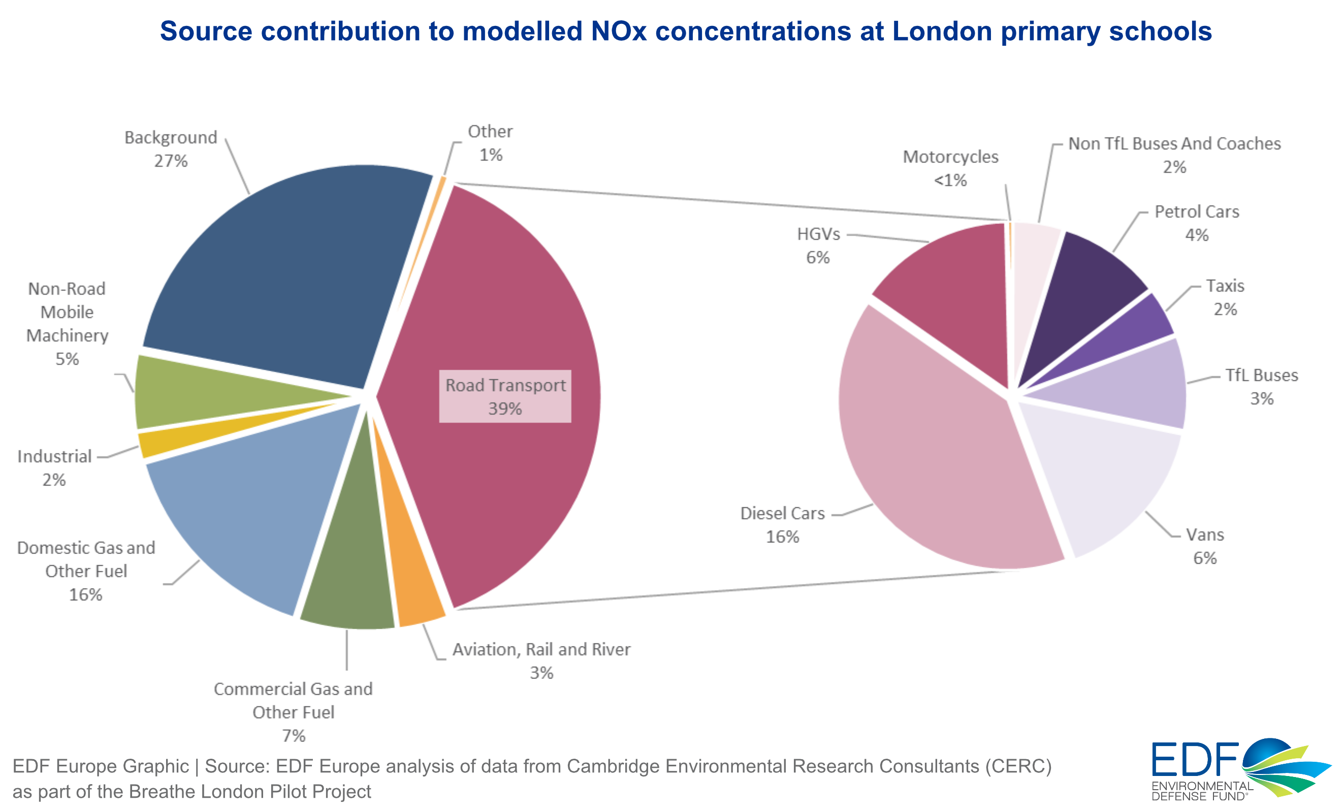
Road transport sources are on average the greatest contributor (39%), followed by domestic and commercial heat and power sources (23%).
-
Digging a level deeper, diesel cars are the largest single source contributor (16%). Diesel cars contribute more pollution than any other individual pollution source, road transport or otherwise (like heavy goods vehicles or commercial heat and power, both at 6%).
-
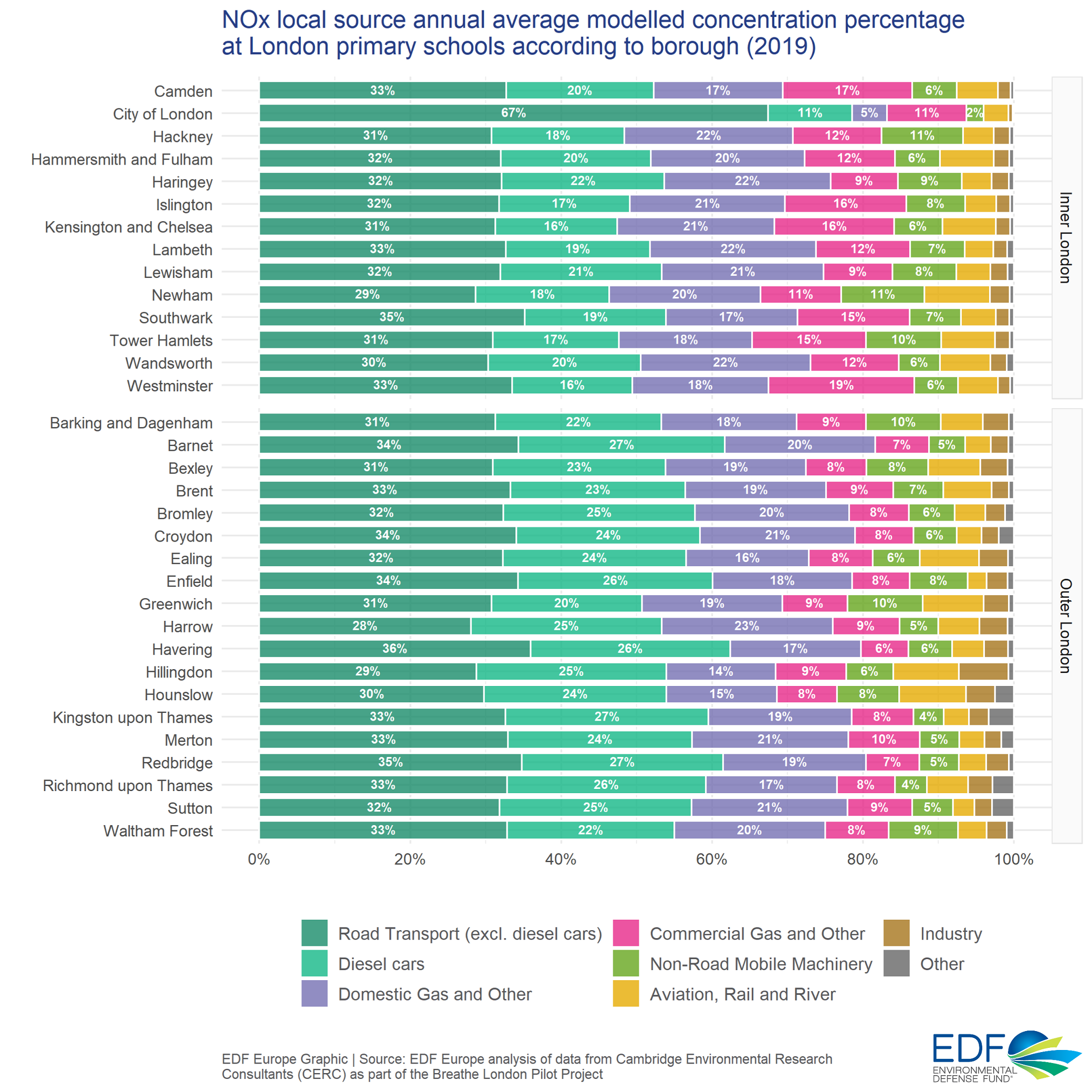
Pollution levels from road transport are on average 19% higher at Inner London primary schools than at those in Outer London.
The chart below demonstrates how diesel cars are on average the largest single source contributor to NOx pollution at London primary schools.
The sources of road transport at schools vary according to London borough. However, City of London is the only borough for which diesel cars is not the largest single source contributor.
One of the boroughs with the highest contribution from diesel cars was Hillingdon. Our recent Cleaner Car Index found that Hillingdon has seen a year-on-year increase in diesel cars with the highest volume of any borough.
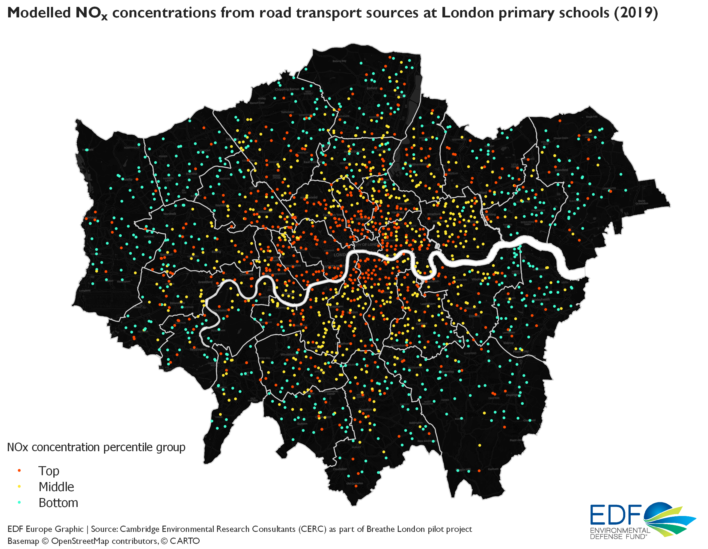
The chart below maps modelled levels of NOx pollution from road transport sources at schools, with each dot representing one primary school. Colours demonstrate how schools with the highest levels of NOx concentrations from road transport tend to be in Inner London, which are on average 19% higher than Outer London.
Data source
This analysis examines a modelled dataset produced by Cambridge Environmental Research Consultants (CERC) using the ADMS-Urban model as part of the Breathe London pilot project estimating the sources of modelled annual-average NOx total concentrations (one metre above ground) at 1,795 primary schools in London in 2019.
For each primary school, rather than modeling pollution directly on or above buildings, CERC created new locations by selecting the nearest road to the school. This was done to give a better representation of the exposure experienced by schoolchildren. It follows previous Breathe London research that shows children are most exposed to pollution on their way to and from school.
The full NOx concentrations dataset and methodology can be found here. All data is provisional.